Mojstrana is a village with a population of 1,100, situated at the foot of the Mežakla plateau and Vrtaška Planina at an altitude of 660 m. It is separated from the neighbouring village of Dovje, which lies at an altitude of 711 m and has 627 inhabitants, by the Sava Dolinka river and the Jesenice–Kranjska Gora main road. In addition to the two villages, the community is also made up of the hamlets of Zgornja Radovna, which lies at an altitude of 787 m at the junction of the Krma and Kot valleys (77 inhabitants), and Belca, which lies in the western part of the community and is one of the starting points for the climb to Kepa. The area is located 20 km to the west from Kranjska Gora, which is the centre of the municipality, and to the east it is 10 km away from the town of Jesenice (the centre of the neighbouring Municipality of Jesenice). Most of the area lies within the Triglav National Park.
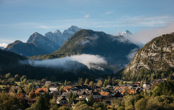 Mojstrana, Matej Lavrač
Karavanke mountains
- Kepa 2,139 m
- Dovška Baba 1,891 m
Julian Alps
- Triglav, 2,864 m
- Škrlatica, 2,740 m
- Stenar, 2,501 m
- Kukova špica, 2,427 m
- Rokavi, 2,644 m
- Dovški križ, 2,542 m
- Cmir, 2,323 m
- Rjavina, 2,532 m
- Debela peč, 2,014 m
- Tosc, 2,275 m
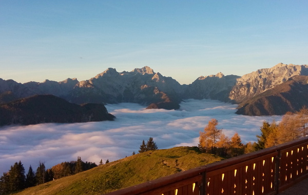 Julian Alps from Karavanke mountains, Slavko Rabič
Mountain pastures
- Dovška Rožca, 1,650 m
- Vrtaška planina, 1,462 m